
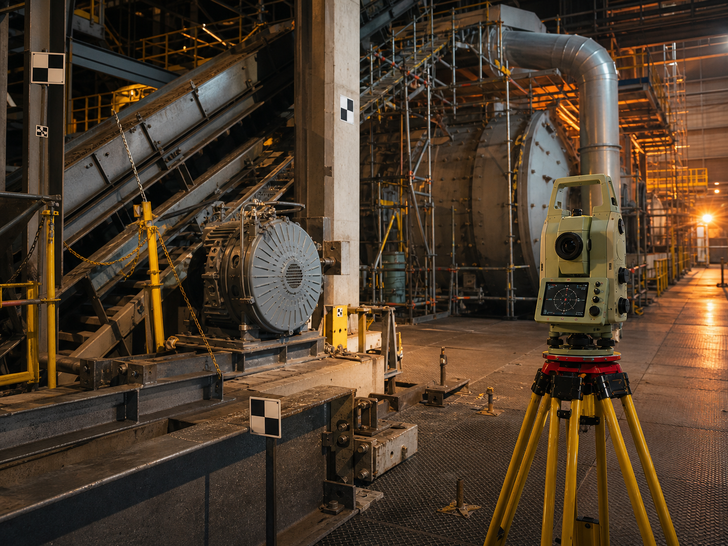
Planning maintenance survey data is the discipline of deciding — before a crew mobilises — exactly which geometry to measure, to what tolerance, against which datum, and in what format, so the numbers your reliability team needs are captured once and remain comparable for years. Done well, it turns periodic surveying from a reactive call-out into a managed dataset that tracks how every critical asset is moving against design. This guide gives maintenance planners, reliability engineers and operations managers a structured way to plan that data: what to capture, how to specify it, what it costs in Australia, and the standards that make it defensible.
Key takeaways
- Plan the data, not just the visit. A maintenance survey is only valuable if this year's reading can be compared to last year's and next year's. That requires a stable control network on GDA2020 / MGA2020 and AHD, re-validated each epoch under the ICSM SP1 uncertainty framework — decide the datum and control strategy first, the instrument second.
- Specify tolerance per asset, not per job. Rotating-equipment centrelines need ±0.5–1.0 mm; crane rail span and level run to ±3 mm and ±2 mm per 10 m under the AS 1418 family; as-built and clash capture is fine at 2–6 mm. Over-specifying wastes day-rate; under-specifying produces data that cannot answer the question.
- Match the instrument to the deliverable. A Leica MS60 or TS16 (or Trimble S-series) for alignment and monitoring; a Leica RTC360 or FARO Focus for as-built point clouds; a DJI M350 RTK for stockpiles, roofs and elevated structures — and every UAV flight needs CASA CASR Part 101 compliance.
- Budget realistically. Crew day rates sit at AUD $2,500–4,500; a single-asset baseline runs $3,500–7,000, a multi-asset capture $7,000–18,000, and remote FIFO mobilisation to the Pilbara or Bowen Basin adds 25–100% before a single point is captured.
- Agree formats and turnaround upfront. Registered point clouds (E57, RCP/RCS), deviation reports, alignment certificates and coordinate schedules take days to weeks to process. State the deliverable, the acceptance criteria and the processing lead time in the scope, not after demob.
Why maintenance survey data needs a plan at all
Most reliability programmes are awash with condition data — vibration, oil analysis, thermography, ultrasonics — but starved of geometric data. Yet a large fraction of recurring mechanical failures are geometry problems wearing a condition-monitoring disguise: the ball mill that keeps eating trunnion bearings because the discharge centreline has crept up 1.9 mm; the overhead crane tripping on motor overload because the runway span has opened past AS 1418.1; the conveyor that drifts no matter how often the idlers are re-trained because the structure has settled. None of these show up in a single inspection. They only become visible when the asset is measured against a stable reference, this year compared with last.
That comparison is the entire reason to plan the data deliberately. A coordinate captured against an unverified control mark, in an undocumented datum, in a proprietary point-cloud format nobody can re-open in three years, is effectively worthless for trending. The job of maintenance survey data planning is to guarantee that every capture is comparable (same datum, re-validated control), defensible (known instrument accuracy, stated uncertainty) and usable (an agreed format with a known shelf life). Get those three right and a survey becomes an asset on the maintenance register; get them wrong and you have paid for a snapshot you cannot trend.
What to capture: mapping assets to measurands
Before specifying instruments, list the assets whose geometry actually drives reliability outcomes, and for each one name the measurand and the decision it informs. The common measurands across heavy industry are:
- Centreline position — the true horizontal and vertical position of a rotation axis (mill, kiln, pump, fan, gearbox drive train). Informs shim and move corrections.
- Straightness — deviation of a line of bearings, idlers or rail from a best-fit line.
- Level, slope and cross-level — critical for kilns, crane runways and conveyor structures.
- Span and gauge — distance between paired elements such as crane runway rails.
- Ovality and shell profile — kiln and mill shells, vessels, tanks.
- Settlement and deformation over time — cumulative foundation or structural movement between epochs.
- As-built geometry — full 3D state for clash, clearance, tie-in design and spares verification.
The discipline is to decide, per asset, whether you need a number (is it in tolerance and has it moved?) or a model (what does it actually look like for design or clash?). The first calls for a total station and a verified control network; the second calls for a laser scanner; "how much is there or what does the top look like" calls for a UAV. Many maintenance programmes need two of the three on the same asset, captured in one mobilisation to save day-rate.
Standards and datums that make the data defensible
Maintenance survey data is governed by a stack of equipment, survey and aviation standards rather than a single rule. The references that come up most on Australian sites:
| Reference | Scope | Relevance to maintenance data |
|---|---|---|
| AS 1418.1 / AS 1418.18 | Cranes, hoists, winches and runways | Rail tolerances and periodic inspection intervals |
| ICSM SP1 | Standard for the Australian survey control network | Uncertainty framework for re-validating control each epoch |
| GDA2020 / MGA2020 | National horizontal datum and map grid | Site coordinates where assets must align to infrastructure |
| AHD | Australian Height Datum | Vertical referencing for level and settlement work |
| ISO 17123 series | Field procedures for testing survey instruments | Justifying claimed instrument accuracy |
| ISO 1940 / 21940 | Rotor balancing quality | Context for vibration that alignment cannot fix |
| CASA CASR Part 101 | Remotely piloted aircraft operations | Mandatory for any UAV/drone capture component |
Two practical notes for planners. First, for pure machine geometry you rarely need GDA2020 — a tight local frame is faster and avoids importing grid scale factor and ppm error into a job where you care about relative millimetres, not absolute position. Connect to MGA2020/AHD only when the asset must be coordinated against site infrastructure or other surveys. Second, the moment any part of the scope uses a drone — RGB or LiDAR capture of an inaccessible gantry, a stockpile, a roof or a flare stack — the operation must comply with CASA CASR Part 101, including operator accreditation or RePL, an ReOC where applicable, and airspace approvals that matter around ports, refineries and regional airfields.
Choosing equipment for the tolerance you need
The instrument is the floor on achievable accuracy — no processing recovers precision the hardware never captured. Match the gear to the tolerance the deliverable demands.
| Equipment | Role in maintenance data | Accuracy |
|---|---|---|
| Leica MS60 MultiStation | Precision centrelines, deformation monitoring | 0.5″ angle; 1 mm + 1.5 ppm |
| Leica TS16 total station | General dimensional control and alignment | 1″ angle; 2 mm + 2 ppm |
| Trimble S-series total station | Equivalent general-purpose alignment | ~1″; 1 mm + 2 ppm |
| Leica RTC360 laser scanner | As-built capture, clash, clearance, ovality | ~2 mm @ 10 m |
| FARO Focus Premium scanner | As-built and structural capture | ~2 mm @ 10 m |
| DJI M350 RTK + payload | Stockpiles, roofs, elevated structures | Task dependent; CASR Part 101 |
For sub-millimetre monitoring and tight centreline work, the MS60's angular precision and Automatic Target Recognition make it the default, particularly for multi-epoch deformation where the same prisms are re-observed over years. For broad dimensional control and routine crane or conveyor work, the TS16 or a Trimble S-series is the workhorse. Laser scanning earns its place when you need full geometry — tyre ovality on a kiln, a clash check before a chute swap, an as-built of a congested transfer tower. For the actual rotation axis of a bearing, however, direct total station observation to a defined target remains more accurate and more directly traceable than fitting a surface to a point cloud.
The maintenance survey data planning checklist
Work through this before each capture. A clean plan is the difference between a single-mobilisation job that feeds your trend, and an expensive return trip for data that turns out not to be comparable.
Scope and measurands
- Listed every asset whose geometry drives a reliability outcome
- Defined the measurand and the decision it informs for each asset
- Stated whether each deliverable is a first baseline or a repeat to be compared
- Located the previous report, baseline and control for any repeat capture
- Decided per asset: a number (total station) or a model (scanner / UAV)
Tolerance and standard
- Set the acceptance tolerance per asset against OEM spec or the relevant AS/ISO
- Confirmed crane runways referenced to the AS 1418 family
- Agreed the operating-temperature / thermal-growth approach for hot assets
Control and datum
- Confirmed a documented control network exists on GDA2020 / MGA2020 and AHD
- Scheduled re-validation of control marks under ICSM SP1 before capture
- Decided local frame vs GDA2020 per asset and recorded it in writing
- Installed any new monitoring prisms / reference targets so they are bedded in
Equipment, access and deliverables
- Matched instruments to tolerances and confirmed availability and calibration
- Confirmed CASR Part 101 compliance and airspace for any UAV component
- Booked access (EWP, scaffold, confined-space permits) against the survey windows
- Agreed deliverable format (E57/RCP, PDF report, coordinate schedule) and turnaround
- Named who certifies accuracy and where the dataset is archived as the baseline
Setting a survey interval that matches the failure mode
The hardest planning question is not what to measure but how often. Surveying too rarely misses the drift you are trying to catch; too often burns day-rate on assets that barely move. Set the interval to the failure mode and the duty:
| Asset / programme | Typical interval | Driver |
|---|---|---|
| Critical rotating equipment (mills, kilns, large fans) | Annual, or after any major event | Bearing change, shell work, foundation disturbance |
| High-duty rotating plant (>8,000 hrs/yr) | Six-monthly | Accelerated wear from continuous running |
| Crane runways | Per AS 1418.18 inspection cycle (commonly 2–3 yearly) | Span and cross-level creep from traffic |
| Conveyor structures | Annual or at major shutdown | Idler-line drift, structural settlement |
| Settlement / deformation monitoring | Quarterly to annually per movement rate | Foundation movement, tailings, new adjacent loading |
| Stockpile volumes (UAV) | Monthly to quarterly | Reconciliation and inventory cadence |
A pragmatic rule: any asset that has not been surveyed in three years and sits on the critical equipment list should be measured as routine maintenance, if only to re-establish a clean baseline. The first survey of an asset is rarely the cheapest insight, but it is the one every later trend depends on.
Budgeting and the real cost drivers
Indicative 2026 guide pricing for maintenance surveying in Australia, excluding GST and travel, for metropolitan and near-regional sites:
| Scope | Indicative AUD | Typical duration |
|---|---|---|
| Crew day rate (instrument + surveyor) | $2,500–4,500 | per day |
| Single-asset baseline (one alignment or one scan) | $3,500–7,000 | 0.5–1 day |
| Multi-asset capture (2–4 assets, one mobilisation) | $7,000–18,000 | 1–2 days |
| Rotary mill / kiln alignment with analysis | $8,000–18,000 | 2–4 days |
| Laser scan as-built (plant area) | $4,000–15,000 | 1–5 days |
| Deformation / monitoring repeat visit | $1,500–3,000 | 0.5–1 day |
| UAV stockpile / elevated capture | $2,500–6,000 | 0.5–1 day |
The cost movers are predictable and rarely the instrument. Remoteness dominates: a Pilbara, Bowen Basin or Mount Isa job adds 25–100% for FIFO, accommodation and mobilisation. Access at height — EWP and scaffold time — eats field days. Permit-heavy confined-space work slows everything. And deliverable complexity swings the back-end: a coordinate schedule is cheap, a fully registered, modelled and reported point cloud is not. Plan the processing time as deliberately as the field time; a registered cloud and deformation report take a week, not a day.
Frequently asked questions
What is the single most important thing to get right when planning maintenance survey data?
Control and datum. Every other decision — instrument, tolerance, format — can be revisited, but if you capture data against an unverified control mark in an undocumented datum, you cannot reliably compare it to past or future surveys, and trending is the whole point. Confirm a documented GDA2020/MGA2020 and AHD network, re-validate the marks under ICSM SP1 before each capture, and record the datum decision in writing.
How do we make sure this year's data is comparable to last year's?
Use the same re-validated control network and datum each epoch, re-observe the same defined targets or prisms, and keep the instrument class and method consistent. Store the data in an open, durable format (E57 for clouds, PDF and coordinate schedules for reports) and archive the dataset and its control as the baseline. Comparability is a planning decision made before the first capture, not something recovered afterwards.
Do we need GDA2020 coordinates for every maintenance survey?
No. Pure machine geometry — a mill centreline, a crane runway, a conveyor line — is best handled in a tight local frame, which avoids importing grid scale and ppm error into a relative-millimetre job. Connect to GDA2020/MGA2020 and AHD only when the asset must be coordinated against site infrastructure, other surveys, or a site-wide settlement monitoring scheme. Most monitoring programmes do tie to the national datum because they will be compared against other site movement.
Can drones cover part of our maintenance data programme?
Yes, for the right measurands. A DJI M350 RTK with ground control is excellent and fast for stockpile volumes, roof and structure condition, flare stacks and inaccessible elevated geometry. It does not replace a total station for alignment or a laser scanner for internal as-builts and clash. Every flight must comply with CASA CASR Part 101, which constrains where and when you can fly on a congested operating site — plan it as a complementary method.
How far ahead should we plan a maintenance survey?
For routine repeats, a few weeks is enough to confirm control re-validation, access and instrument availability. But where the capture must land inside a shutdown — because the asset can only be measured cold, drained or de-energised — lock the survey scope at the same T-12-week gate as your major mechanical work packages, since the access and isolation windows are negotiated months out.
Talk to ISS
If you are building or tidying up a maintenance survey data programme — and you want it planned so every capture is comparable, defensible and genuinely usable for trending — talk to Industrial Spatial Solutions before your next mobilisation. We will help you set the control and datum strategy, specify tolerances per asset, choose the right instruments, and lock realistic field and processing time so the data lands once and lasts. Call 0407 057 015 or contact our team to plan your maintenance survey data, and see our mechanical surveys and shut-down surveys services for the full range of capture we mobilise across Australian mining, processing, ports and manufacturing.