
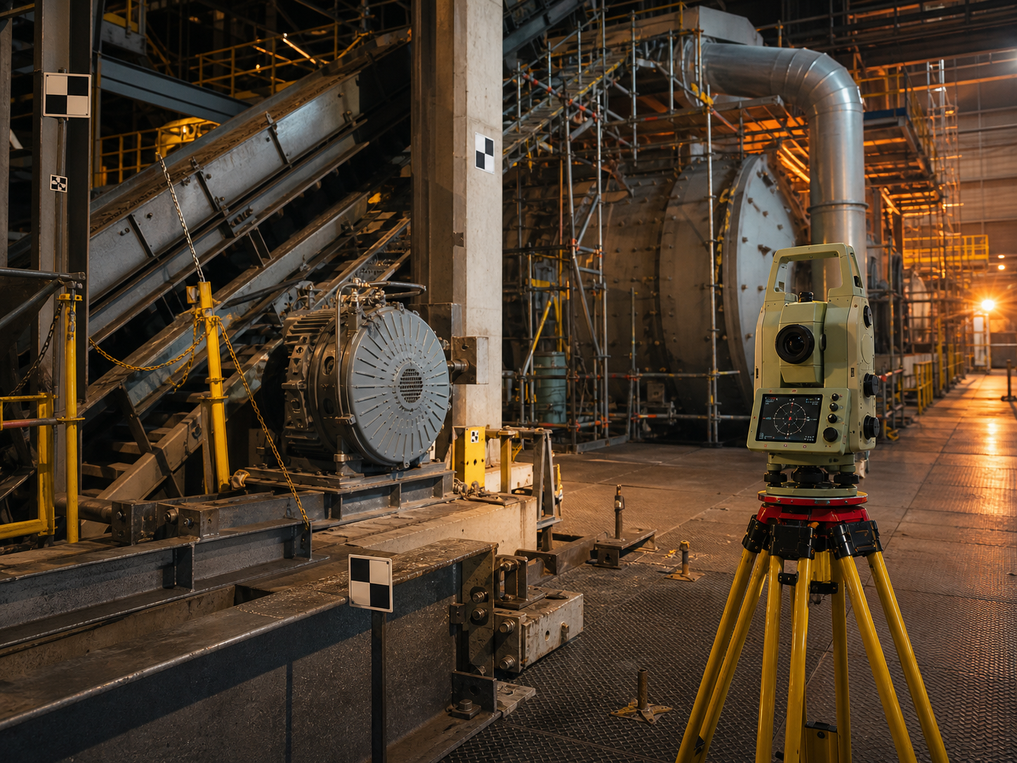
A point cloud as-built survey captures an existing structure, plant or site as millions of measured 3D points using a terrestrial laser scanner, then registers those scans into a single coordinated dataset that records exactly what is there — not what the drawings say should be there. For an Australian engineer, asset owner or designer it answers one core question: will the new pipe rack, conveyor, module or tie-in actually fit the steel, slab and services already on site? This guide covers when to scan, the equipment and accuracy involved, how registration and georeferencing work, what deliverables and level of detail you should specify, realistic AUD costs, and a field-ready checklist to get a usable as-built the first time.
Key takeaways
- A point cloud as-built records reality, not intent — an RTC360 or FARO Focus terrestrial scan captures ~2 mm range noise at 10 m and millions of points per setup, so a clash with existing steel or services is found on screen, before fabrication, not on the critical path during installation.
- Registered network accuracy is the number that matters, not the scanner spec: a well-controlled multi-scan job ties together to 3–6 mm across a building or plant area; cloud-to-cloud registration without survey control drifts, so high-tolerance work is constrained to a total-station control network.
- Georeference to GDA2020 / MGA2020 horizontal and AHD vertical via an ICSM SP1-compliant control network only when the asset must tie to site infrastructure; for pure as-built modelling, a stable local project datum is usually cleaner and avoids importing grid scale factor as error.
- Specify the deliverable and level of detail (LOD) up front — a registered E57/RCP point cloud, a 2D as-built, or a Revit/AVEVA model at LOD 200–350 — because the modelling effort, not the scanning, is where most of the cost and time sits.
- Budget roughly AUD $2,500–4,500 per crew per day for capture; a focused single-area scan-and-register runs $4,000–9,000, and a full scan-to-BIM deliverable for a process building or plant $15,000–60,000+ depending on size, LOD and access.
- For broad outdoor or inaccessible assets, combine a UAV aerial survey for roofs, stacks and gantries with terrestrial scanning for the detail — captured on one mobilisation and merged into a single cloud under CASA CASR Part 101 compliance.
What a point cloud as-built survey actually is
A Western Australian alumina refinery needed to route a new 600 mm slurry line through a 40-year-old process building where the marked-up P&IDs and the original structural drawings disagreed with each other — and, it turned out, with the building. The design house had priced three site visits with a tape and a camera to "confirm dimensions". Instead, a two-day RTC360 scan captured the whole bay: existing pipe racks, cable trays, the floor slab, structural columns and every flange face, as a single registered point cloud tied to the building's column grid. The new line was modelled straight against the cloud, and the design surfaced two clashes the drawings had hidden — a cable ladder and a fireproofed brace directly on the proposed route. Re-routing on screen cost a day of drafting. Discovering it during the shutdown, with the spool already fabricated, would have cost a fabrication rework and lost shutdown hours the client costed well into six figures.
That is a point cloud as-built in one story. A terrestrial laser scanner sits on a tripod, spins a laser through 360°, and measures the range and angle to every surface it can see — returning hundreds of thousands of points per second. Each setup ("scan" or "station") is a panoramic snapshot of geometry from one position; move the scanner, capture overlapping coverage, and you build up a complete digital record of the space. The deliverable is not a drawing — it is measured reality you can section, dimension, model and clash-check from your desk.
The defining principle is capture once, measure forever, against what is real. Traditional as-built methods — a tape, a disto, a camera and a sketch — capture only the dimensions someone thought to take, and miss the interferences nobody anticipated. A point cloud captures everything in view at survey accuracy, so the questions you didn't know to ask on site can still be answered six months later from the cloud.
Key point: the value is in recording everything, accurately, in one coordinated dataset — so design and fit-up problems are found on screen where correction is cheap, not on site where it is on the critical path.
When a point cloud as-built is the right tool
Laser scanning earns its keep wherever existing conditions are complex, congested, hard to access, or expensive to get wrong. On Australian industrial briefs that means:
- Brownfield tie-ins and revamps — routing new pipe, plant or steel into a live process building, refinery, mineral processing plant or power station where the drawings are old, marked-up or simply wrong.
- Scan-to-BIM for design — feeding a registered cloud into Revit, AVEVA E3D or Navisworks so designers model against verified geometry and clash-check before fabrication.
- As-built verification and handover — confirming a newly installed structure, module or rack matches the design model, and producing a defensible as-constructed record.
- Congested plant and structural records — capturing conveyor galleries, transfer towers, tank farms, pump houses and crusher stations where manual measurement is slow and unsafe.
- Heritage, dilapidation and dimensional records — a permanent, accurate snapshot of an asset's geometry at a point in time for litigation, insurance or future works.
It is the wrong tool when tolerances tighten below what registration can hold. Aligning a kiln, checking crane-rail straightness, fitting up machined flange faces or setting anchor bolts to sub-millimetre needs a Leica MS60 MultiStation, a TS16 total station or a laser tracker on a least-squares control network — see our engineering and civil survey services for that precision work. A useful rule: scanning excels at capturing congested geometry to a few millimetres over a whole area; it is not the method for holding sub-millimetre on a single engineered interface. The two are routinely combined — a control network and total station for the tight points, scanning for everything around them.
Equipment and the accuracy it delivers
Three things determine whether your cloud is fit for purpose: the scanner's range accuracy, how well the scans register together, and whether the network is tied to control.
| Instrument | Range noise / accuracy | Best application | Notes |
|---|---|---|---|
| Leica RTC360 | ~1 mm at 10 m (range), 1.9 mm 3D point | Fast plant and building capture | 2M points/sec, VIS-aided pre-registration in field |
| FARO Focus Premium | ~1 mm @ 10 m, ~2–3.5 mm 3D | Detailed indoor/plant as-built | High point density, mature workflow |
| Leica MS60 MultiStation | 1 mm + 1.5 ppm (EDM), 0.5″ angle | Control + targeted scanning | Total station and scanner in one — ties scan to control |
| Leica TS16 total station | sub-mm to a few mm | Control network and registration targets | The backbone for georeferenced scanning |
| DJI M350 RTK (photogrammetry/LiDAR) | 20–80 mm | Roofs, stacks, gantries, wide site | Merges with terrestrial cloud for inaccessible areas |
Note the distinction the scanner spec hides. An RTC360 measuring ~1 mm at 10 m does not give you a 1 mm as-built across a building. Once multiple scans are stitched together, the achievable network accuracy is governed by registration — typically 3–6 mm across a well-controlled plant area, more if the geometry is poor or control is thin. Always quote and accept the registered network accuracy, verified against independent check targets, not the headline range noise.
Processing runs in established point-cloud software — Leica Cyclone or REGISTER 360, FARO SCENE, Autodesk ReCap — with the output exported to neutral and native formats (E57, RCP/RCS, LAS/LAZ, or a structured model) georeferenced before any section or model is extracted.
Registration, datums and control
Registration is the step that turns dozens of separate panoramic scans into one coordinated cloud, and it is where as-built jobs succeed or fail.
Registration method. Modern scanners pre-align scans in the field using visual and inertial cues (the RTC360's VIS technology, for example), and software refines this with cloud-to-cloud matching on overlapping geometry. Cloud-to-cloud is fast and works well over short hops in feature-rich spaces, but error accumulates over long runs — a "leapfrog" down a 200 m conveyor gallery will drift if nothing pins it down. Target-based registration, using checkerboard or sphere targets surveyed by a total station, ties the network to control and stops that drift. High-tolerance or large jobs should use a hybrid: cloud-to-cloud for speed, control targets to hold the frame.
Datum. Tie the deliverable to GDA2020, projected to the correct MGA2020 zone (Zone 50 for the Pilbara, Zone 56 for much of the NSW/QLD coast), with heights on the Australian Height Datum (AHD) — when the asset must coordinate with site infrastructure, foundations, civil works or adjacent surveys. For a self-contained as-built of a single building or module, a stable local project datum (the building's own column grid, for instance) is usually cleaner: it avoids importing MGA2020 grid scale factor and ppm error into what should be a relative-millimetre model. Decide this in writing before mobilisation, and never mix GDA94 and GDA2020 — they differ by roughly 1.8 m.
Control network. Where georeferencing is required, a licensed surveyor establishes control to ICSM SP1 standards using GNSS or total-station traverse, and scan targets are coordinated from that network. Independent check targets — withheld from the registration — then verify the achieved accuracy honestly, rather than relying on the software's internal residuals, which always flatter the result.
Deliverables and level of detail
The single biggest cost driver on a scan job is not the scanning — it is what you ask for afterwards. Be explicit.
| Deliverable | What you get | Typical use |
|---|---|---|
| Registered point cloud (E57, RCP/RCS) | The coordinated cloud, viewable in ReCap, Navisworks, TruView | Design reference, clash-check, archive |
| 2D as-built drawings | Plans, sections, elevations dimensioned from the cloud | Documentation, permitting, marked-up records |
| Scan-to-BIM model | Revit / AVEVA E3D model at specified LOD | Detailed design, digital twin, coordination |
| Deviation / verification report | Colour-mapped comparison of as-built vs design | Handover QA, as-constructed sign-off |
Level of detail governs the modelling effort. Borrowing the BIM LOD scale:
- LOD 200 — generalised geometry, approximate size and location. Suits early design and clash avoidance.
- LOD 300 — accurate geometry modelled to the scan, correct dimensions and positions. The common spec for detailed design and coordination.
- LOD 350 — adds interfaces and connections between elements. Specify where fit-up and tie-in detail matters.
Modelling everything to LOD 350 when LOD 300 would do can double the deliverable cost for no benefit. Specify LOD by system — high detail on the tie-in zone, lower on the surrounding structure — and you pay only for the precision you'll use.
A point cloud as-built scoping checklist
Run through this before mobilisation. Getting it agreed in writing is what stops a re-scan.
- Purpose defined — design reference, clash-check, BIM model, or as-constructed verification? This sets accuracy and LOD.
- Extent marked up — exact areas, levels and systems to capture, with a plan or photos. Scope creep on site is expensive.
- Accuracy specified — required registered network accuracy (e.g. ≤6 mm) and how it will be verified.
- Datum decided — GDA2020/MGA2020/AHD with zone, or a named local project datum. In writing.
- Deliverable and format — E57, RCP, LAS; 2D drawings; or a model at a stated LOD per system.
- Software target — Revit, AVEVA E3D, Navisworks, Cyclone — so the export matches the receiving workflow.
- Access and permits — site induction, permits to work, confined-space or working-at-height needs, isolation and escort requirements.
- Live plant constraints — operating areas, hot work exclusions, traffic, and any windows when access is possible.
- UAV component — any roofs, stacks or gantries needing drone capture, and CASR Part 101 approvals confirmed.
- Control — whether a total-station control network is required for registration and georeferencing.
Costs and timing in Australia
As-built scanning is priced on capture time plus office processing and modelling. Indicative AUD ranges:
| Scope | Typical cost (AUD) | Timing |
|---|---|---|
| Crew day rate (scanner + surveyor) | $2,500–4,500 / day | — |
| Single area scan + registered cloud | $4,000–9,000 | 1–2 days field + processing |
| Building/plant scan-to-2D as-built | $9,000–25,000 | Days field, 1–3 weeks office |
| Full scan-to-BIM (process building/plant) | $15,000–60,000+ | Scales with size, LOD, access |
Two cost levers dominate. Access — a congested live plant requiring permits, isolations and escorts can double field time versus an empty building. LOD — the modelling, not the scanning, is where most office hours go, so specifying LOD by system rather than blanket-high is the easiest way to control the bill. Remote and regional mobilisation (Pilbara, Bowen Basin, Latrobe Valley) adds travel, accommodation and standby on top.
Frequently asked questions
How accurate is a point cloud as-built survey?
Individual scanner range noise is around 1–2 mm at 10 m, but the number that matters is the registered network accuracy once all scans are stitched together — typically 3–6 mm across a well-controlled building or plant area, verified against independent check targets. For anything tighter than a few millimetres on a discrete engineered interface, a total station or laser tracker on a control network is the right tool, not scanning.
What's the difference between a point cloud and a 3D model?
A point cloud is raw measured reality — millions of 3D points, with no intelligence about what is a pipe versus a beam. A 3D (BIM) model is built from the cloud by an engineer who interprets and draws each element as an object at a specified level of detail. The cloud is the measurement; the model is the deliverable you design against. Many clients take just the registered cloud and model only the systems they need.
Do you need ground control or survey control to scan?
For a self-contained as-built of one building or module, cloud-to-cloud registration on a local datum can be enough. For large areas, long runs (conveyor galleries, pipe racks), or anything that must tie to site coordinates, you need a total-station control network and survey targets to ICSM SP1 standards to stop registration drift and hold accuracy. Decide based on extent and tolerance.
Can a drone replace terrestrial scanning for as-builts?
No — they're complementary. A DJI M350 RTK reaches roofs, stacks, gantries and wide areas a tripod scanner can't, at 20–80 mm accuracy, but it can't deliver the few-millimetre detail of a terrestrial scan inside congested plant. ISS routinely merges UAV and terrestrial clouds into a single dataset on one mobilisation, with the drone work flown under CASA CASR Part 101.
What format will I receive the data in?
Commonly a neutral E57 (works across most software), plus native RCP/RCS for the Autodesk/Navisworks workflow or LAS/LAZ for GIS and large-area data. If you want a model, specify the target software (Revit, AVEVA E3D) and the LOD. Confirm format before mobilisation so the export matches your receiving system.
Talk to ISS
Whether you need a quick registered cloud for a brownfield tie-in or a full scan-to-BIM deliverable for a major plant revamp, Industrial Spatial Solutions captures, registers and models to the accuracy and LOD your project actually needs — on Australian sites, to Australian standards and datums. Call us on 0407 057 015 or contact the team to scope your point cloud as-built survey, and we'll tell you honestly whether scanning, total-station control, UAV capture, or a combination is the right approach for your asset.